Icy weather locks in across south-east Australia after crisp winter morning
By Bianca Hall
Icy conditions have swept across south-east Australia, with clear skies and cold, dry air pushed up from the Tasman Sea, creating crisp winter weather that is expected to persist for days.
Weatherzone meteorologist Ben Domensino said parts of Victoria had experienced the coldest June morning in almost 30 years on Wednesday, while cold conditions extended up much of the eastern seaboard.
The lowest temperature recorded in Sydney was at Canterbury, in the inner west, which hit an overnight low of 4.6 degrees at 1.20am. Canberra shivered through a bitterly cold night, with a low of minus 6.1 recorded at 4.10am.
The Queensland town of Dalby, 150 kilometres west of Brisbane, recorded a low of minus 3.6 degrees at 6.38am.
“We’ve seen cold and dry air mass being driven over south-eastern Australia by a low-pressure system in the Tasman Sea, and over the south-east of the country there’s also a high-pressure ridge, which is causing clear skies and light winds,” Domensino said.
“Those weather conditions together are very conducive to cold overnight temperatures, and we’ve seen that weather pattern just persisting … so we’ve been locked in this pattern of very cold temperatures for the last few nights in the south-east of the country, with multiple states seeing temperatures drop below zero.”
The winter solstice on Friday will mark the shortest day and the longest night of the year.
On Wednesday, Melbourne Airport recorded a low of 0.2 degrees – its equal coldest June morning since 1996 – while Omeo recorded minus 6.4 degrees, the town’s coldest June morning since 1995.
In metropolitan Melbourne, the lowest temperature recorded was at Viewbank, which fell to minus 1.9 degrees at 7am – the coldest June morning since 2013. The CBD recorded 1.4 degrees, but the apparent temperature was minus 2.3 degrees.
The cold front pushing cold and dry air up south-eastern Australia has reached as far as Queensland, where frost has been recorded over the past several days, said the Bureau of Meteorology’s Helen Reid.

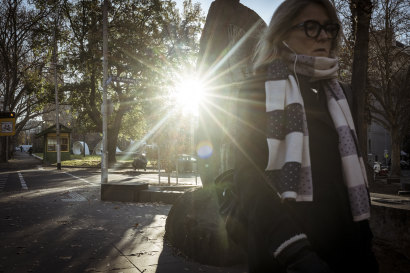
Icy conditions have set in across much of Australia’s south-east.Credit: Chris Hopkins
“And then behind that, we have also had a ridge of high pressure,” the meteorologist said.
“Now that means the cold just settles right down. It just stays put. And with clear skies overnight, we’re able to have that cold air get even colder overnight.”
In the Sydney CBD, the temperature fell to 6.6 degrees at 7.10am on Wednesday, and the city is forecast to reach a high of 16 degrees during the day.
In Hobart, it fell to 4.8 degrees, while in Smithton, on Tasmania’s north-west coast, the temperature dropped to minus 4.5 degrees, the town’s lowest mark since 1996.
Queensland wasn’t immune to the cold either.
The Ipswich suburb of Amberley, west of Brisbane, fell to minus 0.5 degrees at 6.52am on Wednesday, while Brisbane recorded a low of 10.6 degrees, with an apparent temperature of 8.4 degrees.
Across the Nullarbor, Perth recorded a low of 4.8 degrees – well down on the June average of 8.6 degrees.
Weatherzone predicted cool temperatures would persist into Thursday, with the east of the country waiting until Friday for a reprieve before cool conditions return next week.
In its winter long-range forecast, the Bureau of Meteorology predicted an increased chance of unusually warm days and nights for July and September.
Start the day with a summary of the day’s most important and interesting stories, analysis and insights. Sign up for our Morning Edition newsletter.